
Lincolnia Neighbors and Parcels
For a block-level question, each record system answers a narrow question. Map layers show the physical relationship between parcels. Assessment records can show a public owner field and mailing address, subject to suppression. Historical directories can place an address in a dated publication. None of these sources supplies a verified list of all Lincolnia neighbors or proves that a particular person currently occupies a parcel.
| Source | What It Shows About a Block | Access |
|---|---|---|
| Jade/GIS property layer | Parcel geometry, roads, lots, zoning, and political jurisdiction | Public map; click a parcel, use a buffer, and open its PIN report. |
| Master Address Repository | Current or historical addresses plus parcel and street relationships | Public map, table, and CSV; unit and independent-city limits apply. |
| Fairfax iCare | Public owner field, mailing address, assessment, and structure details | Public search; owner suppression is available and occupancy is not established. |
| Deed and plat records | Transfers, shared drives, easements, legal descriptions, and plats | Circuit Court research room or CPAN by instrument or book and page. |
| Voter-list product | Permitted voter fields for an authorized locality or district request | Regulated request and use; protected addresses are redacted. |
| Fairfax PLUS | Address- or PIN-linked permits and land-development records | Public browse and search; a permit does not establish occupancy. |
| Civic association | Public meeting, newsletter, plan-comment, or recreation history | Association or umbrella source; member rosters are not assumed public. |
| Virginia Room | Historical directories, telephone books, maps, and newspapers | In-person or catalog and scan route; confirm date and rights. |
Start with geography, then document the custodian and date of each result. A property owner can use another mailing address, and an adjacent parcel may fall under another political jurisdiction. Those facts make a parcel map useful for a physical-block question, but not a substitute for a private household directory.
Map Lincolnia Neighbor Parcels
The most reliable sequence begins with an exact street address in Fairfax Maps or the Digital Map Viewer. Turn on current property and political-jurisdiction layers before drawing conclusions from what appears nearby. The objective is to identify the parcel geometry and PIN for each adjacent lot, then compare only lawful public parcel fields. A map adjacency is a geographic relationship, not evidence of a personal relationship between Lincolnia neighbors.
- Search the exact address in Fairfax Maps or the county Digital Map Viewer, then verify the returned site and political jurisdiction.
- Activate the current property and political-jurisdiction layers. Click the surrounding parcels or use a small buffer to see their PINs and boundaries.
- Open a PIN report for each parcel that is actually adjacent. Compare parcel location, lot, zoning, and only lawful public owner or mailing fields.
- Use the Circuit Court path for a deed or plat question, and use a current map date when retaining a map export or printed result.
The official sample Lincolnia-area parcel report shows the kind of PIN, plan-district, deed-link, and assessment fields that can anchor an address check.
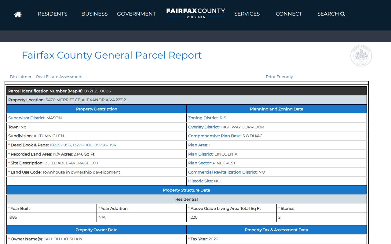
A parcel report is a public record lead. It is not proof that a named owner, mailing recipient, or prior party is a present neighbor.
Lincolnia Neighbor Map Buffers
The county Digital Map Viewer provides map-book, zoning, topographic, soils, flood, and aerial context, while Fairfax Maps connects map research to property and address tools. Use the viewer to inspect the physical block and historic or current map context. A map image does not control a legal boundary. Recorded deeds and a licensed survey govern when a boundary question requires a legal answer.
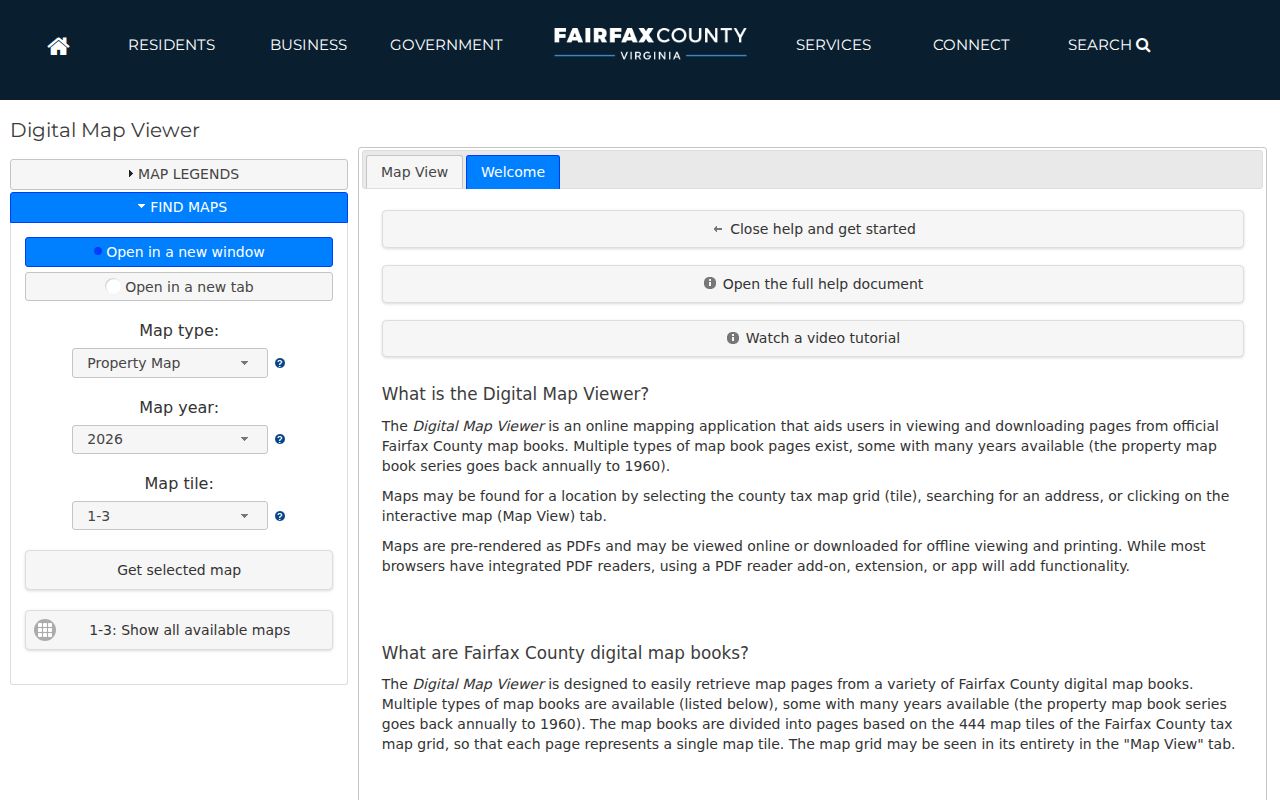
The viewer image illustrates the county map environment used to choose layers and map tiles. Save the selected layer, date, and PIN, rather than relying on an unlabeled screenshot.
iCare map controls support distance and unit settings, parcel-center or parcel-polygon buffers, plus printing, export, and image output. A narrow parcel-polygon buffer is usually clearer than a broad radius around a street address. It reduces the chance that a visually close but nonadjacent parcel will be treated as part of the same block.
Note: Keep the buffer setting with the result because distance, unit, and parcel-center choices can change which properties appear.
Lincolnia Neighbor Boundary First
Lincolnia's Alexandria mailing city is a recurring records trap. The community is in Fairfax County, but an Alexandria postal label does not prove that the parcel belongs to the independent City of Alexandria. Confirm the political-jurisdiction layer before opening a county record. The Fairfax Master Address Repository excludes the City of Alexandria, so a no-result may mean the address is outside its dataset rather than incorrectly entered.
The same check should happen before comparing block results from an older directory, a map, or a civic source. Postal ZIP, Census Designated Place, county planning area, subdivision, and civic-association boundaries can overlap without matching. For a full address-by-address chain along a named road, use the Lincolnia street address directory after the parcel jurisdiction is confirmed.
Lincolnia Planning Name Myth
Plan names are useful search terms, not automatic neighbor boundaries. Fairfax planning materials identify Lincolnia Park, Fairland, Indian Run Park, Little River Village, Lincolnia Mews, Morningside Towers, Strawbridge Square, Duke Street Station, and Virginia Village. Search those names in plan documents, public-meeting material, newspapers, plats, and directories when a block has a local name that does not appear in the parcel record.
Do not assume that a plan name, civic name, CDP label, or ZIP describes the same footprint. Check the county's boundary layer and, where available, an association's own map. This avoids assigning Lincolnia neighbors to an organization based only on a familiar subdivision name.
Boundary tip. Store the address, PIN, subdivision, plan sector, CDP, postal ZIP, and civic name as separate research fields. They answer different geographic questions.
Lincolnia Neighbor Deed Context
Parcel maps are a starting layer. Shared driveways, easements, rights-of-way, lot lines, and subdivision layout are often explained by deeds and plats. The Fairfax Circuit Court land-record research room is the public route for deeds and related instruments. Bring the instrument number or deed book and page from a parcel report when available. Those identifiers make a request more precise than an open-ended search for a nearby address.
CPAN is the subscriber access route for deeper land, probate, marriage, trade-name, and case material. Courthouse terminals remain the practical public alternative for land-record research. A deed can explain a parcel's legal history, but it should never be used to reconstruct suppressed owner information or to create a list of people around a block.
Lincolnia Civic Research Leads
Public civic material can add context that parcel records do not carry. It may identify a meeting, public comment, plan amendment, recreation history, or neighborhood term to search at a library. It does not make association membership public. The strongest local leads found for the Lincolnia area are listed below; each needs a current-page or boundary check before a precise coverage statement is made.
| Public lead | Useful public material | Access and limit |
|---|---|---|
| Lincolnia Park Civic Association | Neighborhood history and public civic context | Use the recreational-club history and public notices, not a member roster. |
| Lincolnia Hills/Heywood Glen | Local civic lead identified in Mason District material | Confirm its current boundary and contact method before using the name. |
| Mason District Council | Umbrella source for civic-association leads and public meeting notices | Verify details with each association's own current source. |
| Fairfax History Commission | Preservation, historic-survey, and county documentary context | It is a context source, not the deed custodian. |
The Fairfax Virginia Room adds the historical access channel for community files, neighborhood directories, maps, newspapers, and telephone books. Ask for public copies or a research appointment, and check scan rights before reproducing a page.
Lincolnia Neighbor Privacy Limits
Public geography has a firm privacy stop. Parcel maps do not disclose private household lists, utilities or delivery customers, unlisted occupants, protected residents, or private association membership. A mailing address can be a business address, family contact, or substitute address. It is not an occupancy statement. Fairfax iCare may show an owner-suppression notice, and that notice must be respected rather than worked around.
Virginia's Address Confidentiality Program provides eligible survivors with a substitute mailing address and restricted physical-address access. Protected voter addresses are also redacted in regulated voter-list products. An absent or substituted address is a legal safeguard, not missing information to reconstruct.
Lawful use. Use public Lincolnia neighbor records for personal, civic, historical, or property-context research. Never use them to stalk, harass, intimidate, or harm anyone.
Note: A public record can be legally available while still being inappropriate to compile into a profile about an identifiable private person.
Lincolnia Neighbor Record Choices
Official sources and compiled neighbor-search categories serve different purposes. Official records identify the custodian, record date, and access boundary. Compiled tools may combine public indexes, marketing data, and user-contributed material, which can be stale or merge different people. Neither category can prove a current household relationship without independent, lawful confirmation.
| Source type | Useful role | Critical limit |
|---|---|---|
| Official parcel, map, deed, or permit record | Checks a place, PIN, public land detail, or dated filing through its custodian | Each field has a distinct meaning; a parcel owner or permit party is not necessarily an occupant. |
| Commercial compiled neighbor-search category | May offer a lead to verify through an official custodian | Data may be old, mixed, incomplete, or inconsistent with a protected address. |
For an election-record question, use the Virginia voter-list request process only within its regulated requester and use rules. The individual Virginia Citizen Portal is an identity-match service, not a block directory. A successful match can show information for the matched voter, but it does not establish the identities of neighboring households.
Lincolnia Neighbor History Context
The Lincolnia Park Recreational Club history describes a civic association formed in 1956, a $15,000 purchase, a plan for 385 shares, 194 shares sold, and a 1957 opening. Those details are useful institutional history for a public block and neighborhood search. They are not a list of present members or a present-day boundary map.
The Fairfax History Commission, established in 1969, has 21 Board-appointed members and meets on the first Wednesday at 7 p.m. according to its official page. It can help connect a neighborhood name to public preservation and documentary context. Keep historical civic material dated, because an old directory or club history does not confirm a current address, phone number, or association boundary.